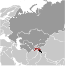
World Atlas: Tajikistan. On this page you can see the map, country flag and many detailed information about the people, history and economy of Tajikistan.

Here you can find online selected information about the geography, inhabitants, government, economy and history of Tajikistan. Included are selected statistics, an overview map and the detailed map of Tajikistan. But let's start with the flag of Tajikistan here:
Tajikistan - Overview:
What you should know about Tajikistan? Let's start with this: The Tajik people came under Russian rule in the 1860s and 1870s, but Russia's hold on Central Asia weakened following the Revolution of 1917. Bands of indigenous guerrillas (called "basmachi") fiercely contested Bolshevik control of the area, which was not fully reestablished until 1925. Tajikistan was first created as an autonomous republic within Uzbekistan in 1924, but the USSR designated Tajikistan a separate republic in 1929 and transferred to it much of present-day Sughd province. Ethnic Uzbeks form a substantial minority in Tajikistan, and ethnic Tajiks an even larger minority in Uzbekistan. Tajikistan became independent in 1991 following the breakup of the Soviet Union, and experienced a civil war between regional factions from 1992 to 1997. Tajikistan has endured several domestic security incidents since 2010, including armed conflict between government forces and local strongmen in the Rasht Valley and between government forces and criminal groups in Gorno-Badakhshan Autonomous Oblast. In September 2015, government security forces rebuffed attacks led by a former high-ranking official in the Ministry of Defense. President Emomali Rahmon, who came to power during the civil war, used the attacks to ban the main opposition political party in Tajikistan. In May 2016, Rahmon further strengthened his position by having himself designated "Leader of the Nation" with limitless terms and lifelong immunity through constitutional amendments ratified in a referendum. The referendum also lowered the minimum age required to run for president from 35 to 30, which would make Rahmon's son Rustam Emomali, eligible to run for president in 2020. The country remains the poorest in the former Soviet sphere. Tajikistan became a member of the WTO in March 2013. However, its economy continues to face major challenges, including dependence on remittances from Tajiks working in Russia, pervasive corruption, and the opiate trade emanating from neighboring Afghanistan.
Geography of Tajikistan
 Where on the globe is Tajikistan? The location of this country is Central Asia, west of China, south of Kyrgyzstan. Total area of Tajikistan is 144,100 sq km, of which 141,510 sq km is land. So this is not a large country. How could we describe the terrain of the country? This way: mountainous region dominated by the Trans-Alay Range in the north and the Pamirs in the southeast; western Fergana Valley in north, Kofarnihon and Vakhsh Valleys in southwest. The lowest point of Tajikistan is Syr Darya (Sirdaryo) 300 m, the highest point Qullai Ismoili Somoni 7,495 m. And the climate is mid-latitude continental, hot summers, mild winters; semiarid to polar in Pamir Mountains.
Inhabitants of Tajikistan
Let's take a look how many people live in Tajikistan. The number is: 8,468,555 (July 2017 est.). So this is not very populous country. Who lives here? Tajik 84.3%, Uzbek 13.8% (includes Lakai, Kongrat, Katagan, Barlos, Yuz), other 2% (includes Kyrgyz, Russian, Turkmen, Tatar, Arab) (2010 est.). What are the languages in Tajikistan? Tajik (official), Russian widely used in government and business. And the religions: Sunni Muslim 85%, Shia Muslim 5%, other 10% (2003 est.). How old are the people in average? 24.5 years. We have to add that this number is the median - so one half of the people is older than this, one half is younger. And what is their life expectancy (at birth)? This: 68.1 years. Where the people live in Tajikistan? Here: the country's population is concentrated at lower elevations, with perhaps as much as 90% of the people living in valleys; overall density increases from east to west. The major urban areas of Tajikistan are: Dushanbe (capital) 822,000 (2015).
Government and Economy of Tajikistan
The capital of Tajikistan is Dushanbe and the government type presidential republic. Let's take a look at the administrative divisions - 2 provinces (viloyatho, singular - viloyat), 1 autonomous province (viloyati mukhtor), 1 capital region (viloyati poytakht), and 1 area referred to as Districts Under Republic Administration; Dushanbe, Khatlon (Qurghonteppa), Kuhistoni Badakhshon [Gorno-Badakhshan] (Khorugh), Nohiyahoi Tobei Jumhuri, Sughd (Khujand). Regarding the economy of Tajikistan, important industrial products are aluminum, cement, vegetable oil. Important agricultural products are cotton, grain, fruits, grapes, vegetables; cattle, sheep, goats. The most important export commodities are aluminum, electricity, cotton, fruits, vegetable oil, textiles and the most important export partners are Turkey 27.8%, Russia 15.6%, China 14.7%, Switzerland 9.8%, Iran 6.5%, Algeria 6.5%, Italy 5.8% (2016). The most important import commodities are petroleum products, aluminum oxide, machinery and equipment, foodstuffs and the most important import partners are Russia 31.2%, China 13.9%, Kazakhstan 12.8%, Uzbekistan 5.2%, Iran 5.1% (2016). How rich is Tajikistan and how rich are people in this country? The most important number here is GDP per capita (PPP): $3,100 (2017 est.). This is a very low number. Let's add that this means Gross Domestic Product per person, which is recalculated with respect to the relative cost of local goods and services. And one more important number - population below poverty line: 31.5% (2016 est.).